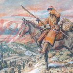
![Introducing the General Zebulon Montgomery Pike INTERNational Historic Trail [ZPIT]](../wp-content/uploads/2018/07/21-St-Anthony-Falls-144dpi-wm-150x150.jpg)


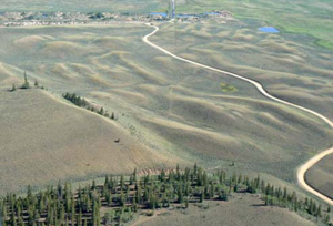
At Christmas, Pike camped on the geological debris of multiple ancient floods.
This is Part One, of a Two-Part Series. Read Part Two.
Three Glaciers Flood, Arkansas River, Colorado
Vince Matthews, Ph.D., formerly the Colorado State Geologist who lived in Leadville at one time spurred thought about where the large rocks came from on the valley floor and a study of the possibility that the Arkansas from its headwaters to Salida was once the headwaters of the Rio Grande River.
Geological Evidence
 Dr. Keenan Lee, Professor Emeritus - Colorado School of Mines, after extensive study, gave our readers in 2015 many incites. Lieutenant Zebulon Montgomery Pike and his men walked into the Upper Arkansas Valley most likely did not notice the large out-of-place rocks scattered on the Valley floor from Twin Lakes [15 mi S of Leadville CO] for 22 miles S to Johnson Village. They were impressed with the snow covered Collegiate Range 14,000 ft mountains. The size of the boulders suggests a catastrophic flood transport, far bigger than any seen here in historic times. 1
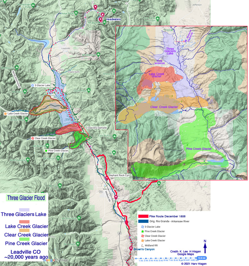
Fig. 1 — Placement of the Three Glacier Flood crime scene
Lake Creek, Clear Creek and Pine Creek Glaciers
20,000 years ago, three glaciers flowed east down to the Arkansas River – one glacier [Lake] pushed the river out of its channel, and the other two [Clear & Pine] crossed the river and rammed into granite walls on the east side of the valley scarring the walls in concave hollows as seen today. These can be called “whamout [forcible impact washout] zones”.
The glaciers formed an ice dam that blocked the Arkansas River and created a large lake above the dam. When the ice dam broke, the entire lake drained catastrophically and the outburst tore down the valley as a wall of water hundreds of feet high. This actually happened twice, about 20,000 years ago and about 120,000 years ago.
Where did the boulders and mounds of sediment topping the granite come from?
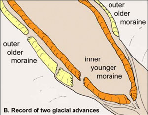
Fig. 2—After glaciers melt, remaining moraines and till mark the former positions of the glaciers.
Previous floods [120,000 years ago] and glaciers covering the Sawatch Range on the west side and partially the Mosquito Range on the east side of the Valley carried large boulders and unconsolidated sediment like mud, sand, pebbles, and cobbles to the Arkansas except for three narrow granite bounded canyons at a) the Three Glaciers damsite [Granite-Clear Ck./Pine Ck], b) Elephant Rock Canyon 10 miles south [north of Buena Vista], and c) Brown’s Canyon [near Salida].
Proof? Innumerable core samples have been taken and the boulders analyzed. Included were of the lateral moraines- the ‘till’ left by the glacier along its sides and at the snout edges and the entrained debris dumped there in unsorted piles [all called till]. After glaciers retreated, the moraines record the former positions of the glaciers. We know about the geographical and geological past of the Valley.
The Dam
Fig. 3—Profile of Clear Creek left lateral moraine and the Arkansas River looking upriver. The end of the moraine was torn away by the flood, but projection of crest shows it reached the Arkansas River at 9350 ft
The Lake Creek Glacier flowed east down and pushed the river onto granite bedrock, but it did not actually stop the river flow. Approx. measurements = 0.6 mi x 0.3 mi x 250 ft = 3168 x 1572 x 250 = 1,245,024,000 cu ft
The Clear Creek and Pine Creek glaciers, however, pushed the Arkansas River up against a steep wall of granite and together formed a dam and stopped the river’s flow. Approx. measurements = 4 mi x 0.83 mi x 520 ft = 21120 x 4282.4 x 520 ft = 48,129,269,760 cu ft
The flowing ice piled up, thickened and spread out upriver and downriver, forming a bulbous mass that from above had a tulip shape. The Pine Creek glacier spread out so much that it effectively merged with the Clear Creek glacier.
A dam elevation of about 9400 ft is a reasonable estimate and therefor its height was ~ 520 feet close to 2 times [1.7x] the height of the Statue of Liberty.
Three Glaciers Lake
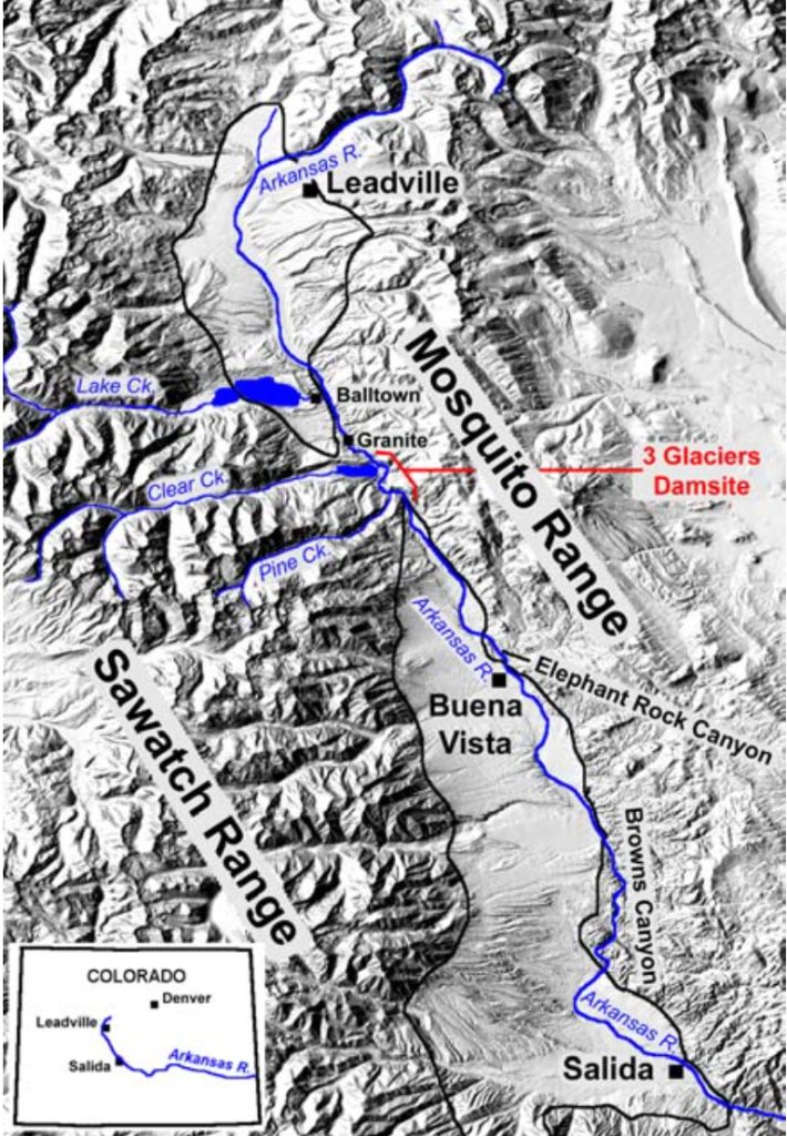
Fig. 4—The Dam Site and terrain from the Arkansas Headwaters to Leadville to Buena Vista to Salida
The dammed Arkansas River backed up behind the glacial dam and created lake, which was more than 500 ft deep at the dam and extended 14 miles up the Arkansas Valley to the Malta substation, just below Leadville.
The Dam Failure
The dam catastrophic failure and instantaneous dumping of the lake was likely caused by seepage around the dam and flotation when the lake level rose to 90% of the thickness of the ice [slowly pour water into a glass containing a single ice cube, at the 90% level the ice cube floats].
As soon as the glacier got high-pressure water under it, it would have been torn apart in seconds, and the lake just catastrophically dumped into the valley below.
Think about this. You’re sitting on top of Mt. Elbert watching a 48 billion cu. ft. piece of ice from the Dam, a 520 ft high wall of dirty water, followed by the 1 billion cu. ft. sheared Lake Creek Glacier, and boulders the size of houses blast through the valley. Cover your ears! The seismic sound would have been deafening.
The Flood
The Arkansas River Valley flat floor saw a wall of dirty water hundreds of feet high tear down the valley.
Two miles below Pine Creek it was still deep enough to leave a four-foot boulder 160 ft up on the side of the valley.
Erosion was severe in the damsite area when floodwaters tore an extremely steep gradient at Pine Creek, where the Arkansas River today drops 50 ft in a distance of 1300 ft, or more than 200 ft/mi.
The Result of These Floods
Last two catastrophic floods caused major changes in the valley. Not only were huge ice and water-rafted boulders [as big as a house] been transported down the valley [some lofted 160 feet above the valley floor] in a matter of minutes; huge scars in the granite walls on the east side occurred opposite Clear and Pike Creeks, terracing the landscape 50 feet above the valley floor and the glacial moraines altered the landscape. The glacial snout [hill] on the east side of Twin Lakes, for example, is glacial till from 120,000 years ago and the lake division occurred 20,000 years ago.
As a result there were mud and till slides at Kolb @ 9400 ft height, Empire Gulch @ 9300 ft height and Mt. Massive Lake area @ 9500 ft height.
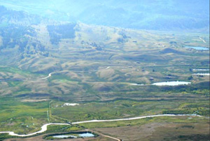
Pic. 3—Mt Massive Lakes on the E side of the Ark
Pic. 4— Kolb on the W side of the Ark N of Twin Lakes/Mt Elbert Forebay
Other Floods
These floods tend to destroy evidence of earlier events. Fragmentary evidence remains of earlier ones. 3. Glenn Scott, the pioneer in flood recognition [Scott, 1984], found a volcanic ash on top of these boulders that he determined came from an eruption at Yellowstone National Park 600,000 years ago, suggesting the flood was at about this time 4. A similar deposit at Buena Vista attest to an even earlier flood. Glenn Scott thinks this one tore down the Upper Arkansas Valley as long as 1.4 million years ago 5.
So Upper Arkansas floods have occurred 1.400,000, 600,000, 120,000 and 20,000 years ago.
The Next Flood
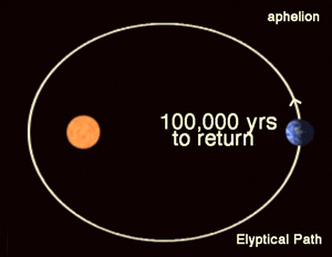
Pic. 5— Elliptical path of the Earth causes Ice ages every 100,000 years
Paleoclimate studies show that in the last 800,000 years there have been 8 ice ages, spaced about 100,000 years apart. [See Fig. 6 below] This climate change occurs because as the earth in its elliptical path around the sun moves farther from the solar energy therefor producing cooler temperatures and eventually ice ages when near its maximum distance called aphelion. [see Fig. 5] In the next 50 kyr, we move constantly closer to perihelion position into global warming. Currently we are moving toward another ice age and the next catastrophic floods in about 80,000 years with or without significant differences.
Legacy of the Catastrophic Floods
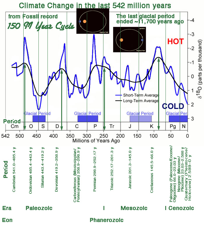
Pic. 6— Evidence in the fossil record show when cooler and warmer climates occurred.
The Three Glaciers Flood created Arkansas River rafting and kayaking opportunities at the Class IV-V rapids of Granite Gorge, rapids in The Numbers, and the Railroad Bridge section of rapids. This valley is a 100,000 year floodplain.
References
1 Lee, Keenan. 2008, http://geology.mines.edu/UserFiles/File/Geology/Three_Glaciers.pdf withdrawn
2 Pierce, K.L., 2003, Pleistocene glaciations of the Rocky Mountains: Developments in Quaternary Science, v. 1, p. 63-76.
3 Scott, Glenn R., 1975, Reconnaissance geologic map of the Buena Vista Quadrangle, Chaffee and Park Counties, Colorado: U.S. Geological Survey Miscellaneous Field Studies Map MF-657, scale 1:62,500. Note: Glenn Scott [deceased] produced the set of Topographic/Historic Maps Of Colorado around 2000.
4 Scott, Glenn R., 1984, Pleistocene floods along the Arkansas River, Chaffee County, Colorado, in Nelson, A.R., Shroba, R.R., and
5 Scott, Glenn R., Quaternary stratigraphy of the Upper Arkansas Valley - A field trip guidebook for the 8th Biennial Meeting of the American Quaternary Association, Boulder, Colorado: p. 51-57, unpublished.