![Introducing the General Zebulon Montgomery Pike INTERNational Historic Trail [ZPIT]](https://www.zebulonpike.org/wp-content/uploads/2018/07/21-St-Anthony-Falls-144dpi-wm-150x150.jpg)

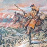

Pike’s Field Maps: They are ones he drew on both of his expeditions and found in his Expedition Journal. They have been visually enhanced. These maps are amazingly accurate. You go, Zeb.
Pike’s (Modern) Route Maps: Drawn to detail the more than 9000 miles traveled by Pike. …Mileage in rivers are accounted for one way. He therefor traveled much more than 8783 miles.
They include:
- 1st Exp.- Mississippi River Fort BelleFontaine to Little Falls, MN (Gen. Zebulon Pike Lake) …He apparently did not draw maps enroute from Little Falls to Cass Lake
- 2nd Exp.- Southwest Fort BelleFontaine to Alamosa, CO. … He did not draw Field Maps from the stockade south of Alamosa into New Spain (NM, MX, and TX)
These maps can:
- Be enlarged by clicking on them
- Printed for your price use. Their use for other than private use is © copywritten

